While the first weekend of August may have started off dry, it ended on a somewhat stormy note. A warm front moving through early Sunday morning sparked numerous showers and thunderstorms, some of which produced flash flooding which resulted in water rescues, and also a couple tornado warnings. After Sunday got off to a bit of a rough start, things were much quieter midday into the afternoon with some clearing sky and just a few spotty showers. Highs climbed to around 90 degrees, but with dew points in the 70s, it felt more like it was in the upper 90s to around 100 degrees. As a cold front approached from the west late in the day and clashed with the hot and humid air, we saw some additional isolated storms fire up, but fortunately these cells never warranted any warnings.
On the heels of our Sunday system is the arrival of tropical moisture tied to Isaias. Isaias' current track hugs the Eastern Seaboard, putting our area in the path of some heavy rain. While the storm will weaken as it moves northward over land, the northern mid-Atlantic will have to prepare for periods of heavy rain Monday night through Tuesday night bringing the potential for flooding before an area of high pressure helps dry things out thereafter.
MONDAY
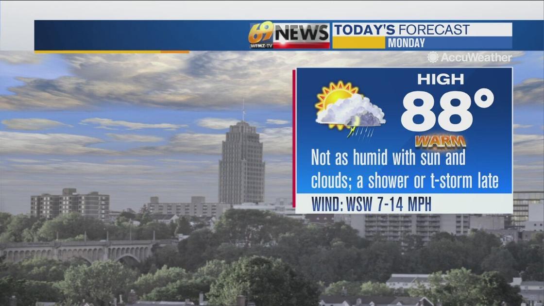
Monday should be dry for a while as sunshine mixes with clouds, and dew points actually drop back into the low to mid 60s making things feel a little more tolerable compared to Sunday. Afternoon high temperatures should still be rather warm reaching the upper 80s in many spots.
Late in the day, another cold front will approach from the west, and out ahead of it, dew points will start to climb higher into the 60s. With these higher dew points providing a little more instability to the atmosphere, the arrival of the front will touch off a few showers and thunderstorms late in the afternoon into the evening, a few of which could contain damaging wind gusts.
Then, as we head through Monday night, we anticipate more widely scattered showers and thunderstorms to overspread the area, some of which may contain heavy downpours, as moisture from Isaias continues its journey northward along the Mid-Atlantic Coast and starts working into our area.
TUESDAY
Monday’s cold front approaching from the west will stall near the region for Tuesday while Isaias continues up the Mid-Atlantic coast. The influx of tropical moisture from Isaias interacting with the stalled front to our west will bring tropical downpours to the region.
Anywhere from 2 to 4 inches of rain with locally higher amounts seems to be in the cards right now for a good chunk of the region based on the National Hurricane Center’s forecast track. The lowest amounts of rain should occur to the west near Interstate 81, while the highest amounts should occur closer to the Delaware River.
Flooding and flash flooding will certainly be a concern Tuesday, although the relatively quick movement of Isaias should limit the threat somewhat. The National Weather Service has placed most of the region under a Flash Flood Watch from late Monday night through late Tuesday night.
Of course, any changes in Isaias’s track could greatly impact how much rain we see, so stay tuned for further updates. With plenty of clouds and damp weather expected Tuesday, look for highs to get no warmer than the upper 70s. It will still be very sticky however with all the tropical moisture around.
WEDNESDAY THROUGH FRIDAY
Isaias will be departing to our north across New England for Wednesday meaning the region will return to drier and sunnier times, although not entirely rain-free. Some lingering moisture in the wake of Isaias first thing Wednesday morning may kick off a few showers, mainly north and east of the Lehigh Valley, however, a good portion of the day should be dry with partial sunshine and highs staying around seasonable levels in the mid 80s.
Humidity will remain high however. High pressure looks to return for Thursday leading to dry weather with a drop in humidity values and a fair amount of sunshine. Highs should also stay close to seasonable levels in the low to mid 80s.
A weak upper level trough approaching from the west Friday may spark an isolated shower or thunderstorm; otherwise, the day should be partly sunny with more seasonable highs in the mid 80s.
The Link LonkAugust 03, 2020 at 04:30PM
https://www.wfmz.com/weather/warm-but-mostly-dry-monday-ahead-of-some-tropical-downpours-tuesday-from-isaias/article_111875ca-d56b-11ea-a27c-b7f89698ce93.html
Warm but mostly dry Monday, ahead of some tropical downpours Tuesday from Isaias - WFMZ Allentown
https://news.google.com/search?q=dry&hl=en-US&gl=US&ceid=US:en


No comments:
Post a Comment