SHREVEPORT, La. (KTAL/KMSS) – We finally have a dry day in the forecast and that will give us an early taste of summer as highs will push 90 degrees this afternoon. The dry weather won’t last long, a line of thunderstorms is expected to return to the northern ArkLaTex late tonight.
You’ll already feel some warm and humid air as you step outside this morning. Sunrise temperatures will be in the low 70s. A little more sun is expected today, overall partly cloudy, with highs in the upper 80s and low 90s. A south breeze will keep our humidity high, so between 2 and 5 p.m. heat index or ‘feels like’ temperatures will be in the mid-90s.

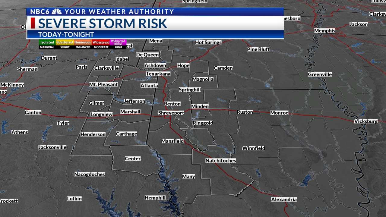
A complex of severe thunderstorms is expected to develop this afternoon north of the ArkLaTex in the southern Plains. These storms will charge out of Oklahoma quickly winding up in the northern ArkLaTex after sunset, but possibly a few hours before midnight. It is during this 8 p.m. to 3 a.m. window that we could see a few storms bring some damaging wind gusts mainly along and north of I-30 in Oklahoma and Arkansas. The Storm Prediction Center has a ‘Slight Risk’ outlook for the northern ArkLaTex, meaning scattered severe storms are possible. A marginal risk will extend into Friday morning for the remainder of the region where severe weather is less likely, but still possible. Large hail and an isolated tornado are lesser threats, but can’t be completely ruled out.

Another threat will be heavy rain. The forecast models are consistent in keeping less than an inch of rain in most areas between tonight and Saturday, but these thunderstorms may be capable of isolated spots where we see 2 inches of rain or more. Given the flooding we had yesterday in Miller and Bowie counties near Texarkana, some of these same areas could experience roadway and neighborhood flooding if the storms were to roll over the same area again tonight.

The cold front responsible for these storms will stall near I-20 Friday. Another round of storms may develop mainly in east Texas and Louisiana Friday afternoon through Friday night. A lingering shower or storm may be possible again early Saturday but we should gradually dry out during the day Saturday. This front will drop humidity and temperatures through Memorial Day. Dry weather remains in the forecast Sunday and Monday, with scattered storms returning by the middle of next week.

Get exclusive severe weather details on storms as they approach your area by downloading the Arklatex Weather Authority app now available in the App Store and Google Play
May 27, 2021 at 05:38PM
https://www.arklatexhomepage.com/weather/hot-and-dry-thursday-strong-thunderstorms-in-some-areas-tonight/
Hot and dry Thursday, strong thunderstorms in some areas tonight - ArkLaTexHomepage
https://news.google.com/search?q=dry&hl=en-US&gl=US&ceid=US:en


No comments:
Post a Comment